Table des matières
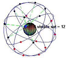
GNSS / GPS
Voir aussi centipede
Visual art
OpenStreetMap
OpenStreetMap est une carte du monde entier librement modifiable, faite par des gens comme vous. OpenStreetMap vous permet de voir, modifier et utiliser des données géographiques de n'importe quel endroit dans le monde.
La suite: osm_3d.
Softs
mobile phone / PDA
MGMaps
http://www.mgmaps.com (J2ME)
Mobile GMaps is a FREE application that displays maps from Google Maps, Yahoo! Maps, Windows Live Local (MSN Virtual Earth), Ask.com, Open Street Map and other sources on Java J2ME-enabled mobile phones, PDAs and other devices. MGMaps can connect to a GPS receiver over bluetooth or use internal GPS features on some phones in order to automatically display the map for your current position. You can pre-download maps and store them on your memory card in order to use them on the go without accessing the internet.
Mobile GMaps is distributed under the Attribution - NonCommercial - NoDerivs Creative Commons license. You may download, use and distribute the application free of charge only for personal, non-commercial purposes.
J2MEMap
Requirements:
- MIDP2.0
- CLDC1.0/1.1
It's a small interface to GoogleMap that allows you to do the following things:
- Browse the entire GoogleMap database
- Swith from GoogleMap/Satellite, MSN Virtual Earth Maps, Ask.com and Yahoo!Maps
- Switch between satellite or map view
- Zoom in/zoom out
- Do request to google maps, and show results on screen
- Save your favorite locations
- Have access to some rss feed to discover some new locations
- Can be extended with your own data
- Automatic painless saving of your preference…
- Use an embeeded GPS if present, to be automatically located
- Use an external GPS connected with Bluetooth, if present
- Support of GPX/KML/LOC file format
- Support for touch screen enabeld handsets
- new:Track management: record, load, save track
- new: Import/Export track from internet, bluetooth, or lical file system
- new:Take and upload geotagged pictures to Flickr
- new: And some fun stuff: browse realtime the Flickr geotagged pictures!
- new: Find Fon hotspot near you with your mobile phone!
Dev
J2ME (Java2 Micro Edition)
JSR 179: Location API for J2ME
JSR : JSR 179: Location API for J2ME
Implementation et Documentation : http://www.forum.nokia.com/Tools_Docs_and_Code/Documentation/Java/Java_API_Specifications.xhtml#jsr179
Codes source
http://silentdevelopment.blogspot.com/2009/11/followme-12-free-java-me-gps-tracking.html
http://www.qcontinuum.org/gpstrack